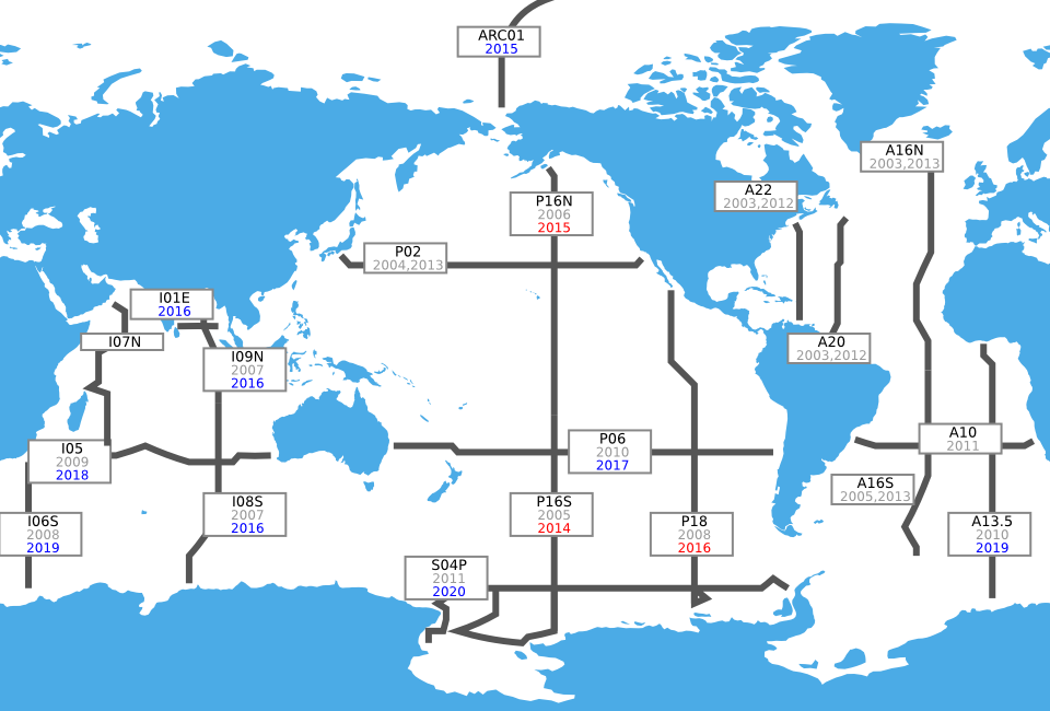
Cruises for the U.S. Global Ocean Carbon and Repeat Hydrography Program, -
(Red indicates a pending cruise, grey indicates a completed cruise, Blue indicates a proposed cruise)
Map Download:
The map is available to download in two formats, a rasterized version for display on other websites and a resolution independent
vector version for suitable for publications. These maps were last updated on 2014-02-13.