
02 October 2013
Dear Family, Friends, and Colleagues,
A few hours ago we finished our planned line of stations 525 nautical miles straight south from 67°S (roughly the Antarctic Circle) to the Antarctic continental shelf, stopping every 30 miles to make measurements. This completes for the first time the southern end of a long transect of oceanographic measurements extending from Kodiak Island, Alaska, to Antarctica, known to oceanographers as "line P16". The entire ship's company carried this out with their usual expertise, efficiency, and good cheer. We have all enjoyed the good weather and lack of equipment problems. The last group of 5 closely-spaced stations were carried out in highly varied and increasingly more impressive ice ranging from the smallest newly-formed frazil ice that "greases" the sea surface, to new "pancake ice" of various sizes (very easy going), to first (easy) and multi-year (hard) sea ice, to impressively thick pieces of broken off ice shelf (impossible), to mighty icebergs (likewise). The Palmer's mates and our expert ice pilot Vladimir Repin enjoy the challenge of guiding the ship through the maze of ice - they can slide and power easily through the easy ice but of course must not hit the big stuff. It gets spicier at night, which is when Vladimir has his fun. The ship's large bridge (where the ship is steered) has great all-around views and is The Place To Be when one has a bit of time off, though the weather has been so good that many have bundled up a bit and tried watching icebreaking from the bow or other points outdoors on the ship. The ice and icebergs provide many photo opportunities and we frequently come across penguins and basking seals. Icebreaker novices and old hands alike are enjoying this E-ticket ride (younger readers may have to look up that term).
As we worked our way south we edged closer and closer to the edge of the "footprints" of both of the geosynchronous INMARSAT satellites (one over the Atlantic equator and the other over the Pacific equator) that provide our primary email communications - we are so far south that even though these satellites sit in orbit thousands of miles above the equator, they are below our horizon. Sometimes we can "see" one of the satellites and the RPSC techs do a quick burst of email exchanges. In one sense it matters little - we are self-contained and have everything we need to complete our work - but we do grow accustomed to exchanging information, ideas, and correspondence with those ashore, and so the interruption reminds us how far away we really are here in the far south.
One of the oddities of working west-east (or east-west) in the Pacific Ocean is the date line. Most oceanographers and experienced travelers reading this are well aware of it, but many people ashore find it hard to understand that somewhere (i.e., the date line) the date and day of the week must change by one unit forward, if one is traveling west, or backwards, if traveling east. Indeed, we did that crossing (eastward) some time ago but saved our change to celebrate St. Patrick's Day (Thursday, March 17th) twice on the ship, once today and again tomorrow. (If we had been going west we would have skipped one day/date when we made the adjustment.) This does not affect the times we record with our measurements one bit because for those we use "Universal Time", which was formerly known as "Greenwich Mean Time".
Our cruise is now approximately at its half-way point. We are steaming west toward the sites where we will recover two strings of moored instruments co-chief scientist Alex Orsi deployed February 2010. We will then resume our CTD work with our third crossing of the Antarctic continental slope.
It is no surprise that I continue to enjoy working with our team at sea. I may have planned a very long cruise but with this team it is a productive and happy one. All is well aboard the Nathaniel B. Palmer.
Jim Swift
Chief Scientist
NBP-1102 / S04P
Photos this week include a beautiful sunset/iceberg photo by Nancy Williams, Wilson Mendoza's photo of two Emperor penguins, a photo showing several of the many ice types we see, a photo showing the view from the bridge (with second mate Brandon Bell and PO grad student Eric Mortenson), and a photo showing a group of penguins who are living on an iceberg, including a few living surprisingly high up on it.
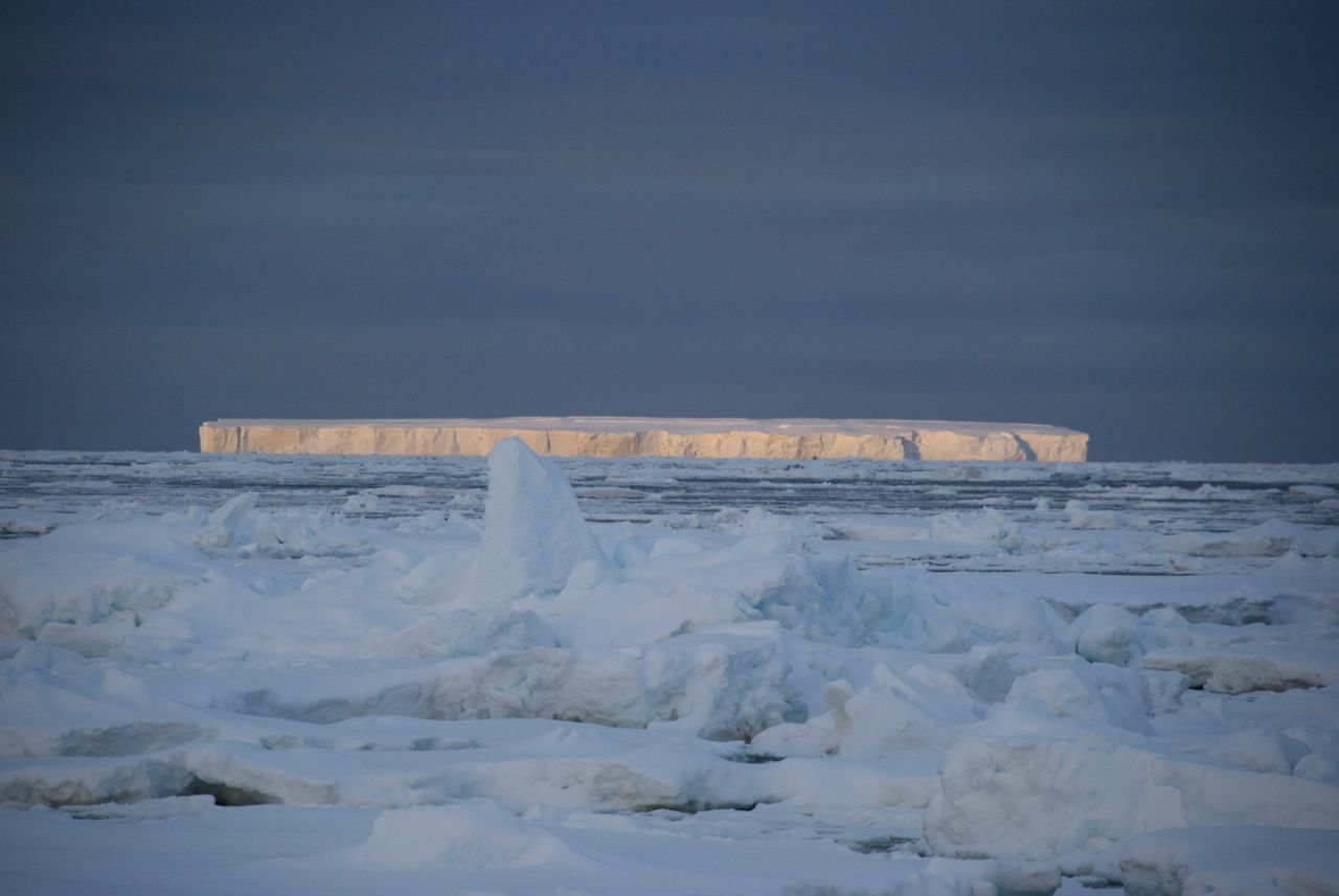 Iceberg at sunset (Nancy Williams)
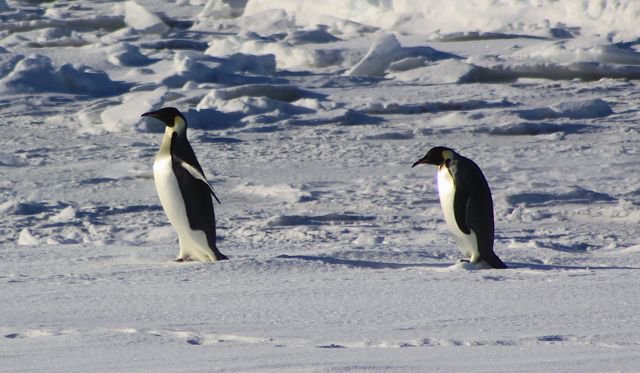 Two Emperor penguins (Wilson Mendoza)
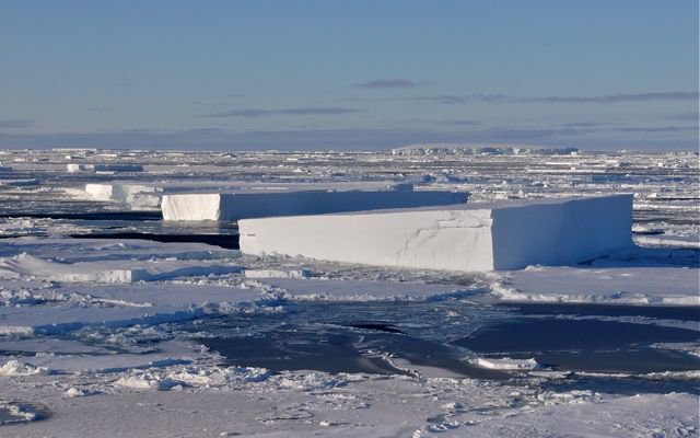 Many ice types (Swift)
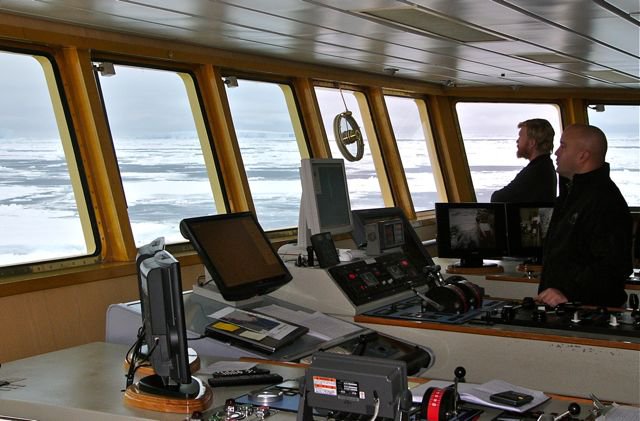 View from the bridge (with second mate Brandon Bell and PO grad student Eric Mortenson (Swift)
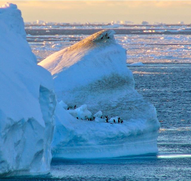 Group of penguins who are living on an iceberg (Swift)