
02 October 2013
Dear Family, Friends, and Colleagues,
We've had a different sort of week than just one CTD station after another. First we enjoyed a thrilling transit through all sorts of ice, dodging zones where heavy ice would significantly slow us down, with a gorgeous sunset and moonrise. Then it was time to recover two vertical arrays of bottom-anchored instruments co-chief scientist Alex Orsi deployed during February 2010.
Each instrument cable was anchored to a heavy weight on the bottom, with subsurface floats pulling the cable taut, instruments were attached to the cable, and an "acoustic release" connects the cable to the anchor weight. In the following paragraph note that to recover a mooring you must first find it (none of it is at the surface while it is deployed), and you must be able to communicate with the release device (done with coded acoustic signals). If those are both successful (by no means guaranteed), you need daylight and reasonably good weather to recover it, which means in statistical terms less than 50% of the time on this cruise. Of course, the long line of instruments will hopefully rise to the sea surface after the acoustic release has been told to let go from the anchor, and you have to be able to see it - not as easy as you might think. And on top of that, you need to be careful when you grab it and haul it in.
When we reached the first of the mooring sites, Alex and Woods Hole mooring expert Jim Ryder (we are most fortunate to have him on board with us for our mooring work) went right to work. Thanks to GPS, they knew where the first string of instruments was supposed to be. The Captain brought the Palmer near that point and they tried to communicate with the mooring's release devices, but received only a weak, partial answer. After working the ship through a search pattern, stopping every now and then to try again, they learned that the releases were more than a mile away from where they had been set down - perhaps an iceberg dragged the mooring sometime during the year. Trouble was, it was now too dark to try to recover the mooring. So we did a short line of CTD stations overnight. In the morning the weather was too iffy for a mooring recovery, so we headed over to the second mooring, about 32 miles away, to try to verify its location. By then the weather was seriously deteriorating and so we were able to do no more than learn that it, too, had been dragged, more than two miles. Further work was impossible and so we headed into the ice pack to wait out an impressively ugly storm. With blocks of ice being tossed about the sea surface in 60-knot winds, thank goodness we were safe on a sturdy icebreaker! When conditions improved, we headed to the first mooring site (the closest), where Jim and his team from the ship (our marine techs and the graduate students) recovered the mooring with few problems. Then we returned to the second mooring site, and in growing darkness its releases were acoustically triggered, and, voila, there was its blinking light beacon! The recovery was trouble free and Alex got back every instrument he deployed.
Oceanographers reading this may be interested to note that during our lines of CTD stations at each mooring site we saw water at several hundred meters depth that was colder than the freezing point at the sea surface. This can take place when cold water circulates and is cooled under floating, very deep reaching Antarctic ice shelves. This was the first time I had observed such water myself.
We then had a long steam to the start of our next line of CTD stations. Alex brought along several cases of eXpendable BathyThermographs (XBTs), small disposable instruments which provide a temperature profile from a moving ship. The students and a couple of other helpers dropped XBTs every 30 minutes over the day and a half transit.
My chief responsibilities with respect to a research cruise have to do with (a) preparing a cruise plan ahead of the cruise, (b) seeing that an appropriate team with its equipment is put in place to carry out the plan, (c) monitoring progress at sea, and then (d) modifying the plan as or if needed. With respect to (a), I am guided by world class experts such as Alex Orsi, Kevin Speer (at Florida State University), Stan Jacobs (at Columbia University), and the members of the science oversight committee for the US Global Ocean Carbon and Repeat Hydrography program - plus many others - so that goes well. Item (b) is easy with this team: I am honored to be able to work with these technical specialists, with the expert captain, mariners, engineers, and support staff Edison Chouest Offshore provides on the Nathaniel B. Palmer, and our experienced group from Raytheon Polar Services. Item (c) sort of takes care of itself since we keep records of, well, everything. Then there is (d). I remind myself that "if it was a good plan ashore it is still a good plan at sea". But what do I do when, by my accounting, we have already lost 7 full days due to bad weather? Yet, some other aspects - the station work and time slowed down in ice in particular - have gone remarkably well in our favor. I listen to good advice, and make a decision.
The cruise to date included work of such high scientific priority that I felt compelled to complete it as planned, without reduction, waiting out weather. But now as we begin the second half of this long cruise, I have decided to allot specific amounts of time to each remaining segment of the cruise except for a few "must complete, no matter what" activities. This is one way to get around the unknowns. The Captain is happy to work in a somewhat similar manner: within proper maritime limits he can allocate fuel in a cruise-segment manner roughly similar to my allocation of time. (The ship uses far more fuel breaking ice than traversing open water, and also burns significantly more going, say 11 knots than 9 knots in open water.) Both of us plan when and where we will apply our resources and where we will hold reserves.
I have thus determined that we will have a go at a south-to-north line of stations along 170°W I had been prepared to cut just days ago. I allocated sufficient time to do it, and we will complete as much of it as the weather permits. Then we will move on to the next segment. But no rushing, no change in the way we work. I'll let you know how this goes!
All is well on the Nathaniel B. Palmer.
Jim Swift
Chief Scientist
NBP-1102 / S04P
Photos this week include moonrise and an iceberg by Juan Botella, Wilson Mendoza's photo of a line of Adelie penguins, my photo of ice and water at sunset, and Ryan Woosley's and Juan Botella's photos of a mooring recovery. In Juan's photo, co-chief Alex Orsi is on the left, mooring expert Jim Ryder is left of center, and RPSC marine tech Barry Bjork is on the right.
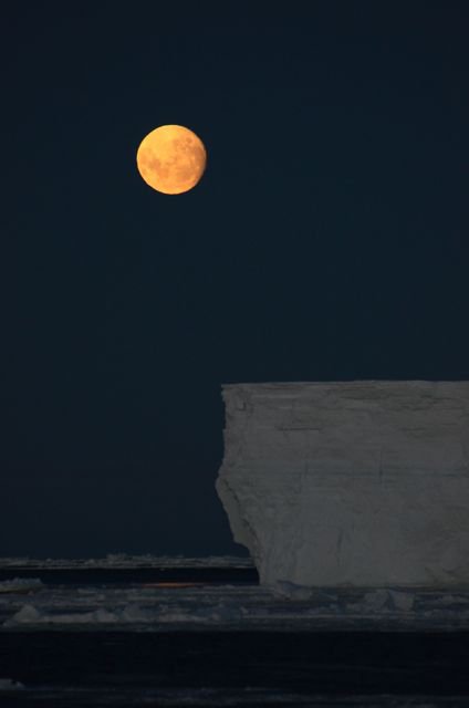 Moonrise and an iceberg (Juan Botella)
 Line of Adelie penguins (Wilson Mendoza)
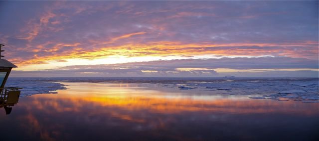 ce and water at sunset (Swift)
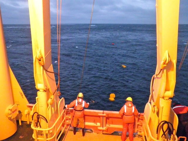 Mooring recovery (Ryan Woosley)
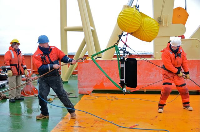 Mooring recovery with Alex Orsi, Jim Ryder, and Barry Bjork (Juan Botella)